- Helpline Number : +975-17-33-44-22
- Mail Support : bhutaninbound@gmail.com info@bhutaninbound.com
Snowman Trek I
Overview
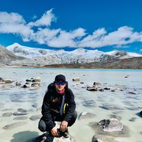
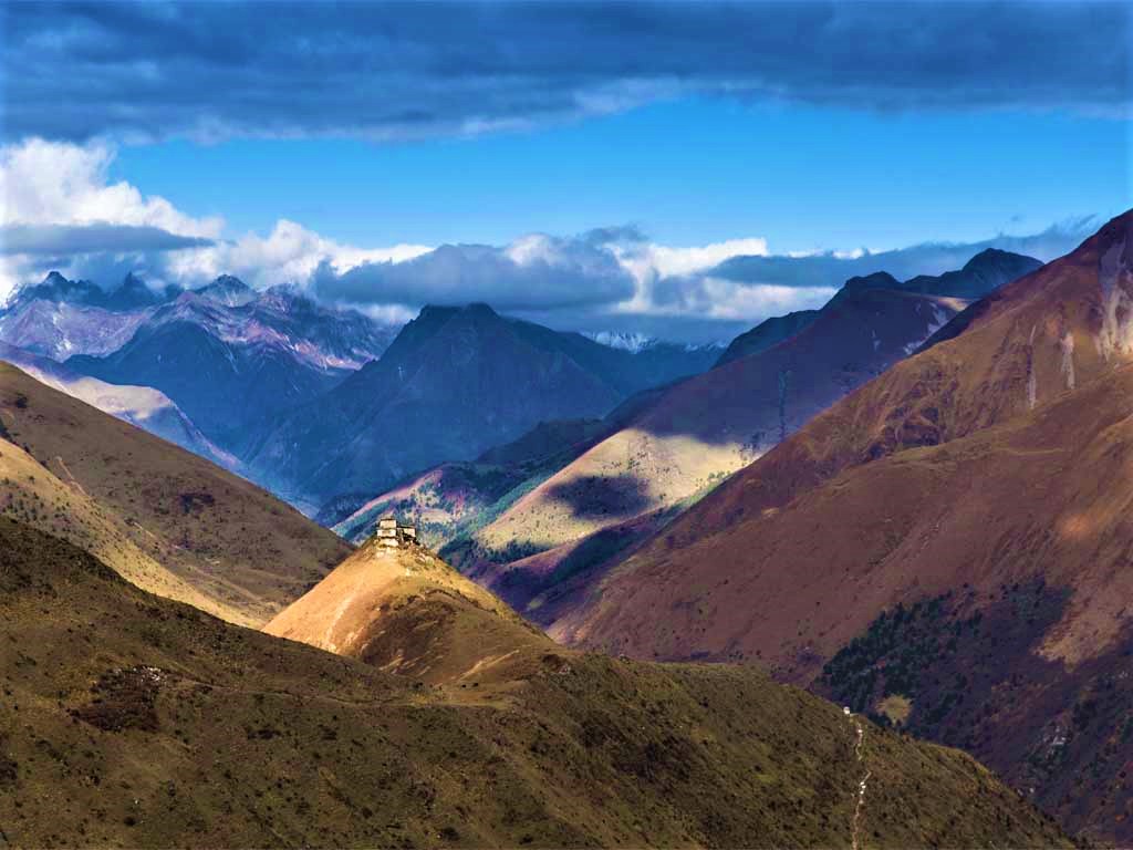
The Snowman Trek I is an extension of the beautiful Laya Gasa Trek and leads from Laya into the high altitudes of the Bhutanese Himalayas. It takes tough and enduring trekkers into the Lunana region and further on to Gangkar Puensum and Sephu in Trongsa district. The Snowman trek leads through the most remote areas up to very high altitudes. Trekkers have to camp in altitudes above 5,000m more than once, and depending on the seasonal temperatures, the camps are sometimes on snow.
Duration: 25 days, Max. Elevation: 5,320m
Highest Camp: 5,050m
Standard: Hard
Best Seasons: Mid June to Mid October
Start: Gunitsawa Village, Paro Valley
Finish: Sephu (Trongsa)
Package Details :
Duration : 29 Nights / 30 Days .
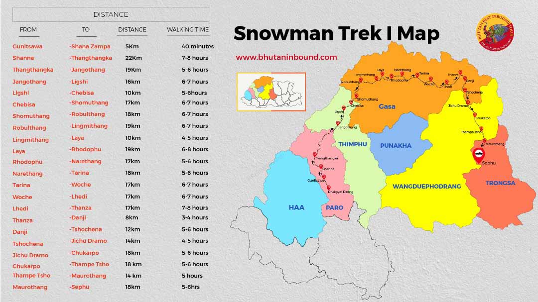
Destination Covered : Paro - Gunitsawa Village - Sharna Zampa - Thangthangkha - Jangothang - Lingshi - Chebisa - Shomuthang - Robluthang - Limithang - Laya - Rhodophu - Narethang - Tarina - Woche - Lhedi - Thanza - Danji - Tshochena - Jichu Dramo - Chukarpo - Thampe Tsho -Maurothang - Maurothang - Sephu - Punakha. .
Day 01: Arrive At Paro
.png)
Altitude at Paro 2,300 meters
Paro is a beautiful valley located in Western Bhutan with an area of 2800 Square kilometers. Breathtaking Lhakhangs and monasteries are perched on mountain hills. Two sacred rivers with its respective source at Jumolhari and Chumo Phug mountains, makes their way through Paro valley enhancing its beauty and grandeur.
- Visit “Paro Dzong” also known as Paro Rinpung Dzong – “the fortress of the heap of jewels”. This structure serves as the house for the district monastic body and government administrative office of Paro.
- Visit to Ta Dzong, which in the past served as watchtower for Paro Dzong for protection from invaders. Now, it is the National Museum of Bhutan and houses artifacts dating back to 4000 BCE.
- Take a stroll through Paro town, a street of typical Bhutanese traditional buildings.
Overnight: Hotel in Paro
Day 02: Hike to the Legendary Taktsang Monastery
Taktsang Monastery: the Taktsang, popularly known as the “Tiger’s Nest” is perched on the side of a cliff at a height of 900 m above the Paro valley. It is considered as a signature spot for the tourist visiting Bhutan. It is a Gem of a Paro Valley. Nestled up in a cliff, it is considered one of the twelve wonders of the world.
After breakfast, drive to Ramthangka to hike up to the viewpoint of Taktsang (Tiger’s Nest) (2950m). The round trip will take about two to three hours. The legend says that in the 8th century, Guru Rinpoche visited and meditated here for some time. The place now is one of the holiest pilgrim sites for the Mahayana Buddhists.
Later visit the ancient Kichu Lhakhang which dates back to the 7th century.
Overnight: Hotel in Paro
Day 03: Gunitsawa Village – Shana Zampa (Trek Starts)
This trek begins at Gunitsawa Village where you pass the army post. At the army check post, your trek permit (provided by your tour operator) will be checked and endorsed. The campsite is on the opposite side of the river, not far from Gunitsawa.
Camp altitude: 2,850 m
Overnight: Camp at Shana
Day 04: Shanazampa- Thangthangka
On this long day, the trail continues with lots of small ups and downs. After going uphill through the river valley the valley finally narrows gradually to a mere path which descends to a meadow where a camp will be set up. From here, if weather permits, you will have the first great view of Mt. Jomolhari.
Elevation at Campsite: 3,610 meters/ 22Kms/ Time: 7-8hours
Overnight: Camp at Thangthangka
Day 05: Thangthangka – Jangothang
If you did not see Mt. Jomolhari the previous evening, you will still have a chance to get a great view early this morning. This morning the trek continues up the Paro Chhu valley which widens into patches of alpine meadow and scanty growths of forest. You will cross an army checkpoint along the way and enjoy a spectacular view of high mountain ridges and snow-capped peaks. In this area yaks and their herder’s homes become a regular feature of the landscape. Passing the villages Soe, Takethang and Dangochang is another asset on this day. After reaching Jangothang, one of the most beautiful campsites of the Himalayas, you will again have a spectacular view of Mount Jomolhari.
Distance 19 km, 5-6 hours, 480 m ascent, camp altitude 4,080 m.
Overnight: Camp at Jangothang
Day 06: Jangothang Halt
The rest day in Jangothang provides plenty of possibilities for day hikes with great views of lakes and snow-capped mountains such as Jomolhari and Jichu Drake. There are good chances to spot some blue sheep on the upper slopes of the valley. Jangothang is a perfect environment for your acclimatization. You can also trek up to Tosoh or hike around the area. There are good short hiking trails in three directions. Jomolhari and its subsidiary mountain chains lie directly west, Jichu Drake to the north and there are a number of unclimbed peaks to the east.
Overnight: Camp at Jangothang
Day 07: Jangothang – Lingshi
Today is one of the longest days of the trek. A short distance from your camp, the trail begins climbing for about half an hour and then gradually ascends to the Nyilila Pass (4,870 m).
While climbing up, you get to enjoy the serene surroundings. You may see a herd of blue sheep grazing on the slopes. From the Nyilila Pass you will have spectacular views of Mt. Jomolhari, Tsherimgang, and Jichu Drake. From the pass, it is a gradual descent to the camp where you will pass by some yak herder’s tents made of yak wool.
As you come down into the Lingshi basin, a beautiful U-shaped valley, you will get a magnificent view of Lingshi Dzong.
Distance 18 km, 6-7 hours, 840 m ascent, 870 m descent, camp altitude 4,010m.
Overnight: Camp next to a quaint stone hut.
Day 08: Lingshi – Chebisa
Today is the shortest walking day, and you can really take it easy. Shortly after starting you will reach a chorten below Lingshi Dzong. Here, you have the choice of staying on the main trail or taking a detour up to the Lingshi Dzong (4,220m), which sits right atop a high ridge. This Dzong is under reconstruction from a 2011 earthquake which damaged its central building. In addition to a very special atmosphere of mystic tranquility, Lingshi Dzong provides a great view over the valley. After Lingshi Dzong you will be passing the villages of Lingshi and Goyul. In Goyul, the stone houses are clustered together to form a small compact village that is unusual in Bhutan where settlements are usually scattered. On reaching the campsite at Chebisa you will have plenty of time to visit the village houses if you feel up to it. There is also a beautiful waterfall located behind the village that is worth visiting.
Distance 10 km, 5-6 hours, 280 m ascent, 410 m descent, camp altitude 3,880 m.
Overnight: Camp at Chebisa
Day 09: Chebisa – Shomuthang
The morning starts with a long ascent behind Chebisa village (2-3 hours) through a wide pastureland towards Gobu La (pass). On the way, you will see a few people herding yaks. There is also a great chance to spot large herds of blue sheep above the trail. After crossing Gobu La (4,410m), you descend into the valley, then climb again a little bit, before descending again to Shakshepasa (3,980), a large U-shaped valley. Climbing from here you will finally reach the campsite at Shomuthang, above a river, which is a tributary of the Nochu River.
Distance 17 km, 6-7 hours, 890 m ascent, 540 m descent, camp altitude 4,220 m.
Overnight: Camp at Shomuthang
Day 10: Shomuthang – Robluthang
You begin by climbing up the valley to view Kang Bum (6,526 m) and some edelweiss. After two hours of climbing you will reach Jhari La (4,750m), from where you catch the first glimpse of Sinche La, the pass you will have to cross the day after. The big snow peak in the north is Gangchhenta 6,840 m, better known as the Great Tiger Mountain. If the weather is clear, Tserim Kang and the top of Jomolhari will be visible. The camp by the river is called Tsheri Jathang located in a beautiful wide and remote valley. Herds of takin, the Bhutanese National Animal, migrate to this valley in summer and remain for about four months. The valley has been declared a takin sanctuary. Climb up a little bit and you will reach the campsite at Robluthang in a rocky meadow.
Distance 18 km, 6-7 hours, 700 m ascent, 760 m descent, camp altitude 4,160 m.
Overnight: Camp at Robluthang
Day 11: Robluthang – Limithang
The trek starts out with an initial 40-60mins ascent before gradually raising for another 1.5 hours through a boulder field. It is then a 1-hour steep ascent before reaching Sinche La (5,005m) – the final and highest pass on the trek if you don’t intend to continue the Snowman trek from Laya onwards. As you descend the far side of the pass, you will see an impressive terminal moraine and a glacial lake at the foot of the valley. You can see classic examples of lateral moraines where the glacier has pushed rocks up both sides of the valley. Below the moraine, you cross the Kango Chhu and soon reach the Limithang campsite. The peak of Gangchhenta towers over the campsite even though it’s quite a distance away.
Distance 19 km, 6-7 hours, 850 m ascent, 870 m descent, camp altitude 4,140 m.
Overnight: Camp at Limithang
Day 12: Limithang – Laya
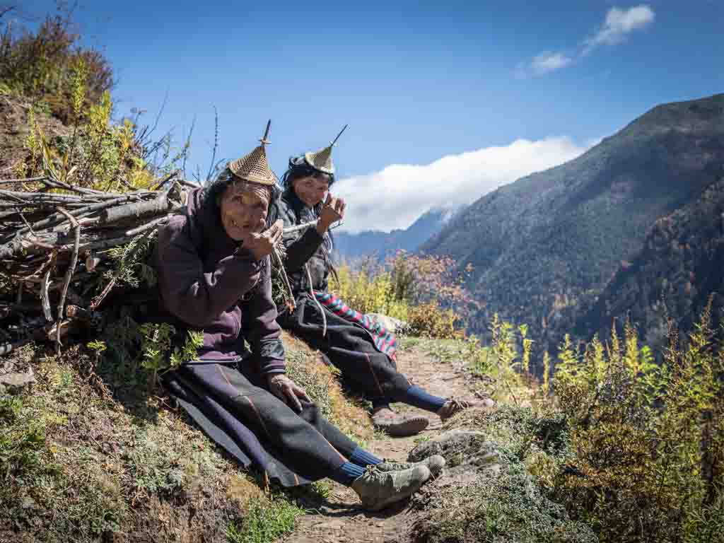
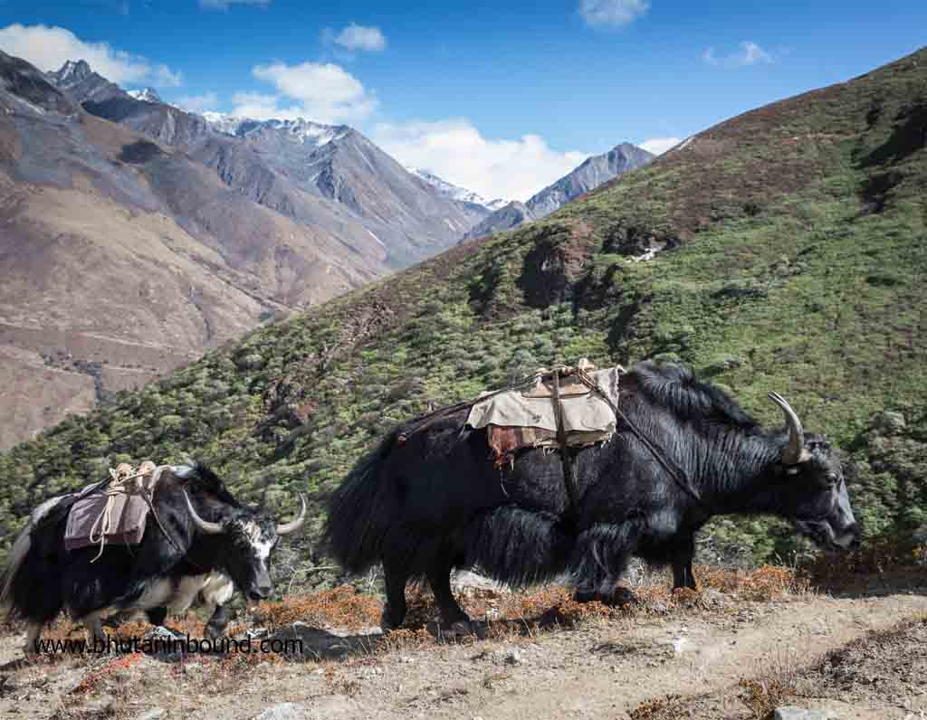
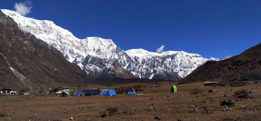
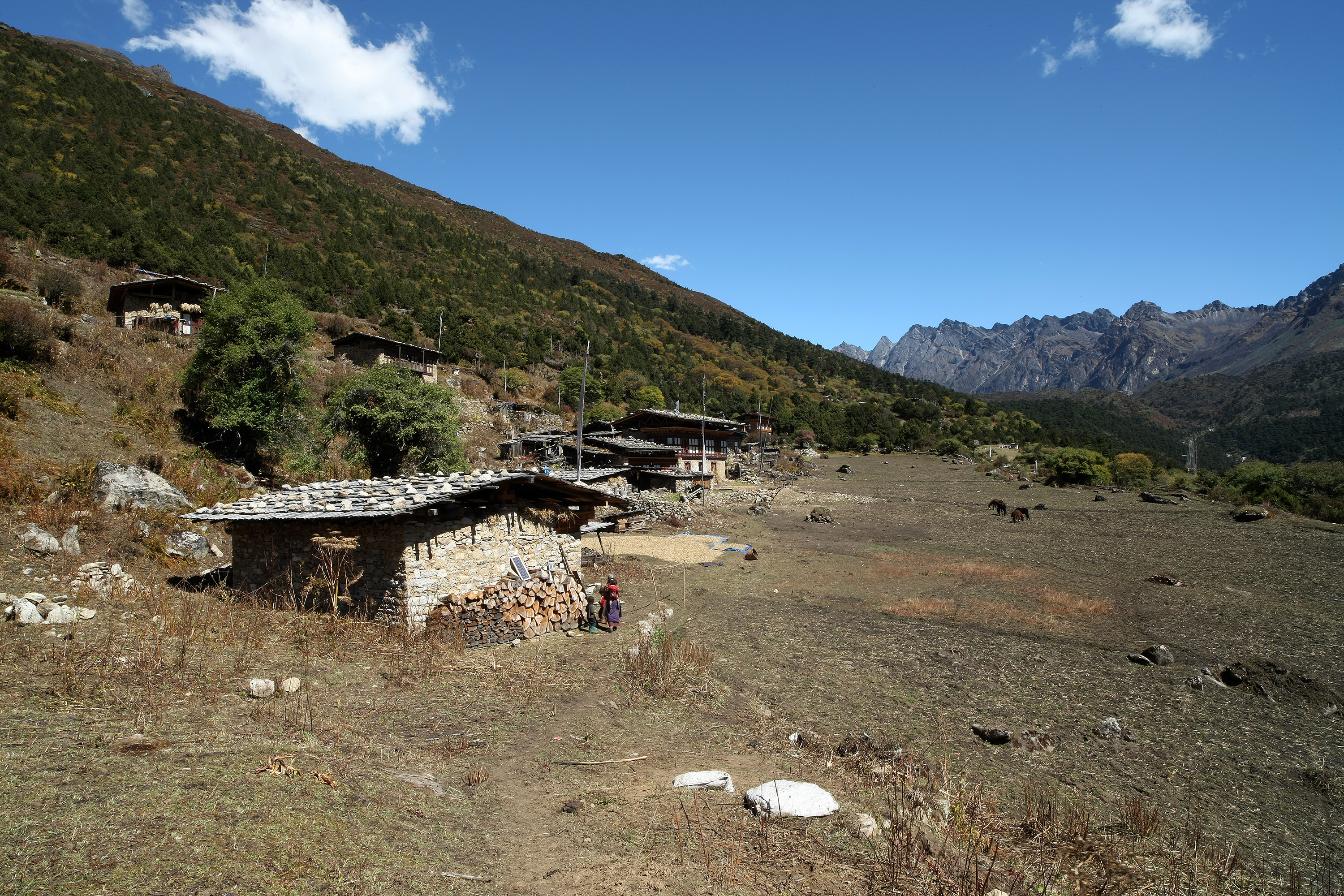
It will be a bit shorter today and particularly a beautiful walk through the forests of pine and juniper to reach Laya, the village is renowned for its pointed hat and turquoise jewelry and people’s welcoming nature. In the village center is a community school and a basic health unit with telephone connection. We will be camping below the school.
Distance 10 km, 4-5 hours, 60 m ascent, 340 m descent, camp altitude 3,840 m.
Overnight: Camp at Laya
Day 13: Rest / Acclimatization Day in Laya
If you have trekked from Paro Valley you should spend a day recuperating from the trek to Laya and preparing yourself for the rest of this challenging but spectacular trek. If you have started from Gasa (Punakha) you should also walk up to Laya to acclimatize, and not just stay at the trail junction to Lunana. It’s worthwhile to spend one day in Laya just for the great views from Laya and its extraordinary inhabitants.
Overnight: Camp at Laya
Day 14: Laya – Rhoduphu
From Laya, we descend to an army camp and continue following the river till the turn off point to Rhoduphu. After lunch the climb continues through rhododendron bushes till you reach the camp at Rhoduphu just next to the Rhodu Chhu.
Distance 19km, six to eight hours, 1,030m ascent, 750m descent, camp altitude 4,160m.
Overnight: Camp at Rhoduphu
Day 15: Rhoduphu – Narethang
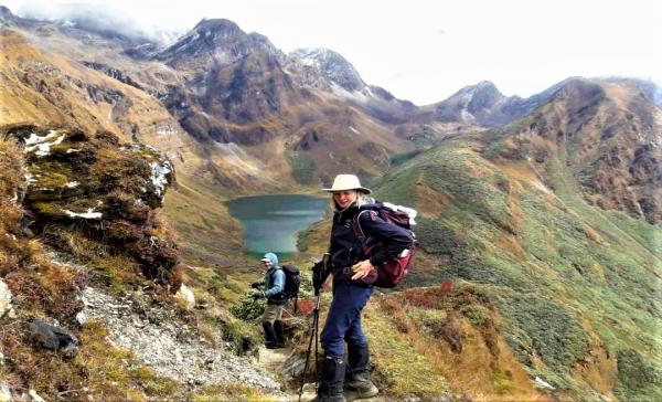
After following the river for about half an hour you will have a steady climb to a high open valley at 4,600m and then further up to Tsomo La (4,900m). Tsomo La offers a superb view of Lunana, Mount Jomolhari and Jichu Drake, and the Tibetan border. The route then crosses a flat, barren plateau at about 5,000m. The campsite at Narethang is towered by the peak of Gangla Karchung (6,395m).
Distance 17km, five to six hours, 740m ascent, camp altitude 4,900m.
Overnight: Camp at Narethang
Day 16: Narethang – Tarina
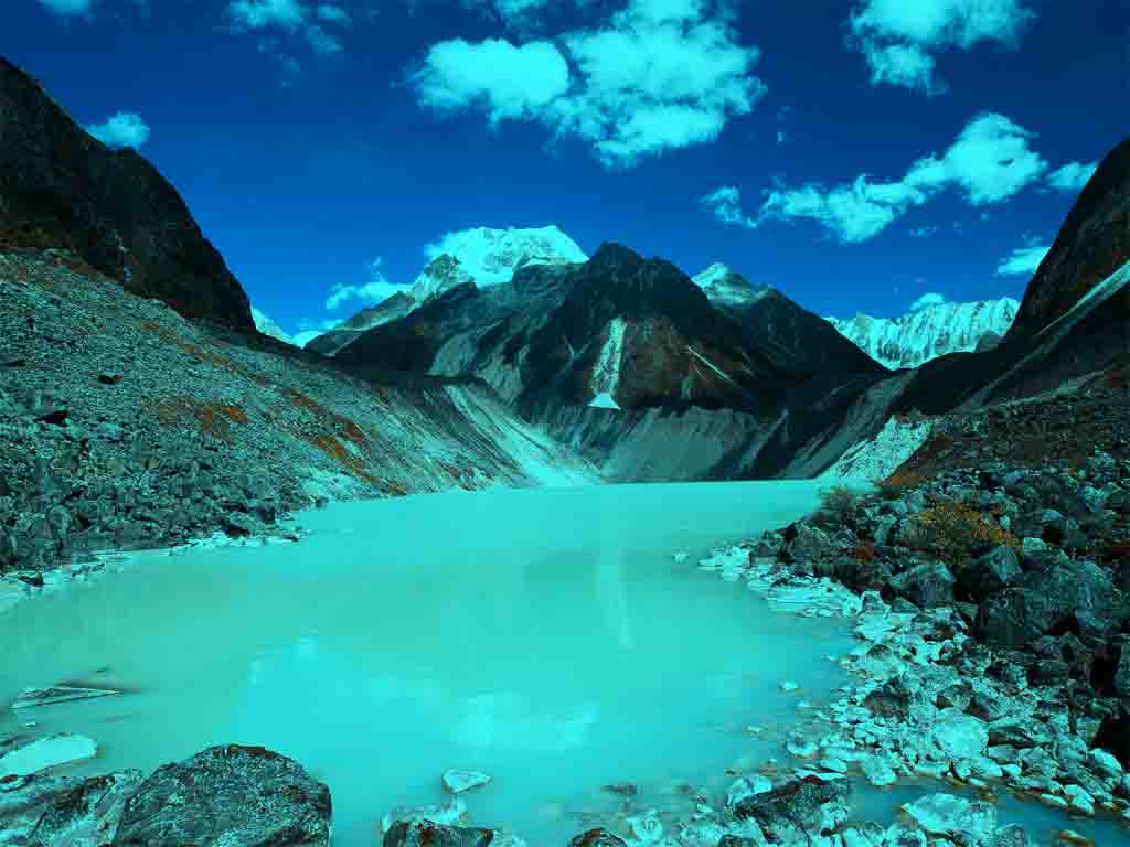
From the camp you will climb for about an hour to Gangla Karchung La (5,120m). The view from the pass is breathtaking, and the whole range of mountains including Jekangphu Gang (7,100m), Tsenda Kang and Teri Gang (7,300m) can be seen. The pass descends along a large moraine. Again one has great views: a massive glacier descends from Teri Kang to a deep turquoise lake at its foot. Up here a glacial lake burst through its dam in the early 1960s, causing widespread damage and partially destroying Punakha Dzong. Finally, it is a very long descent through thick rhododendron to Tarina valley, where you will find several good campsites along the Tang Chhu.
Distance 18km, five to six hours, 270m ascent, 1,200m descent, camp altitude 3,970m.
Overnight: Camp at Tarina
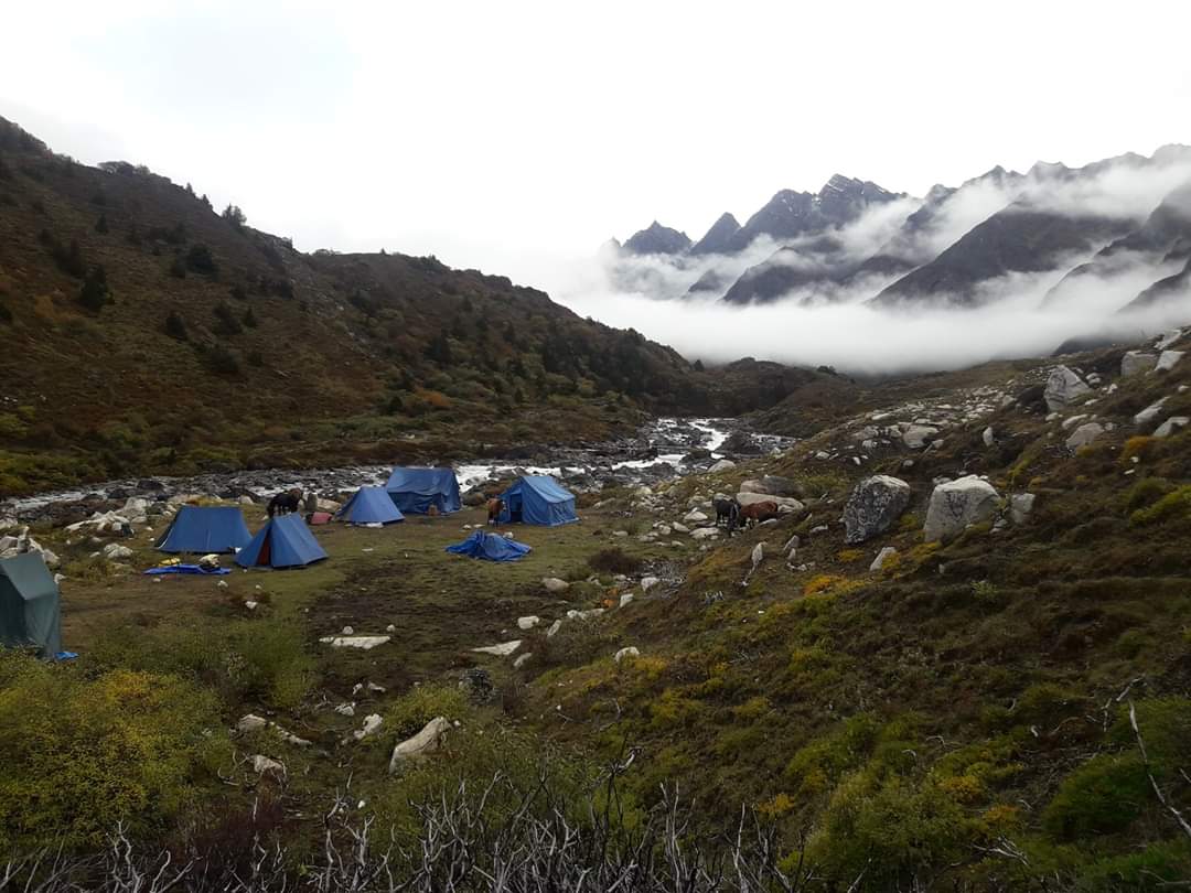
Day 17: Tarina – Woche
The trek leads through conifer forests, impressive waterfall to the upper ridges of Pho Chhu. The trail then climbs over the ridge and drops down to Woche, the first village in Lunana region.
Distance 17 kms, 6 - 7 hours, 270 m ascent, 330 m descent, camp altitude 3,910 m.
Overnight: Camp at Woche
Day 18: Woche - Lhedi
The trek starts through juniper and fir forests, and further ahead, through rhododendron bushes. Climb up to Keche La pass (4,650m) where one can have the great view of surrounding mountains again. After the pass, descend to the riverside walking through a village with a stunning view of Table Mountain and others. Follow up the river till Lhedi Village. Lhedi has a basic health unit, a school and a wireless telephone connection.
Distance 17km, six to seven hours, 980m ascent, 1,190m descent, camp altitude 3,700m.
Overnight: Camp at Lhedi
Day 19: Lhedi - Thanza
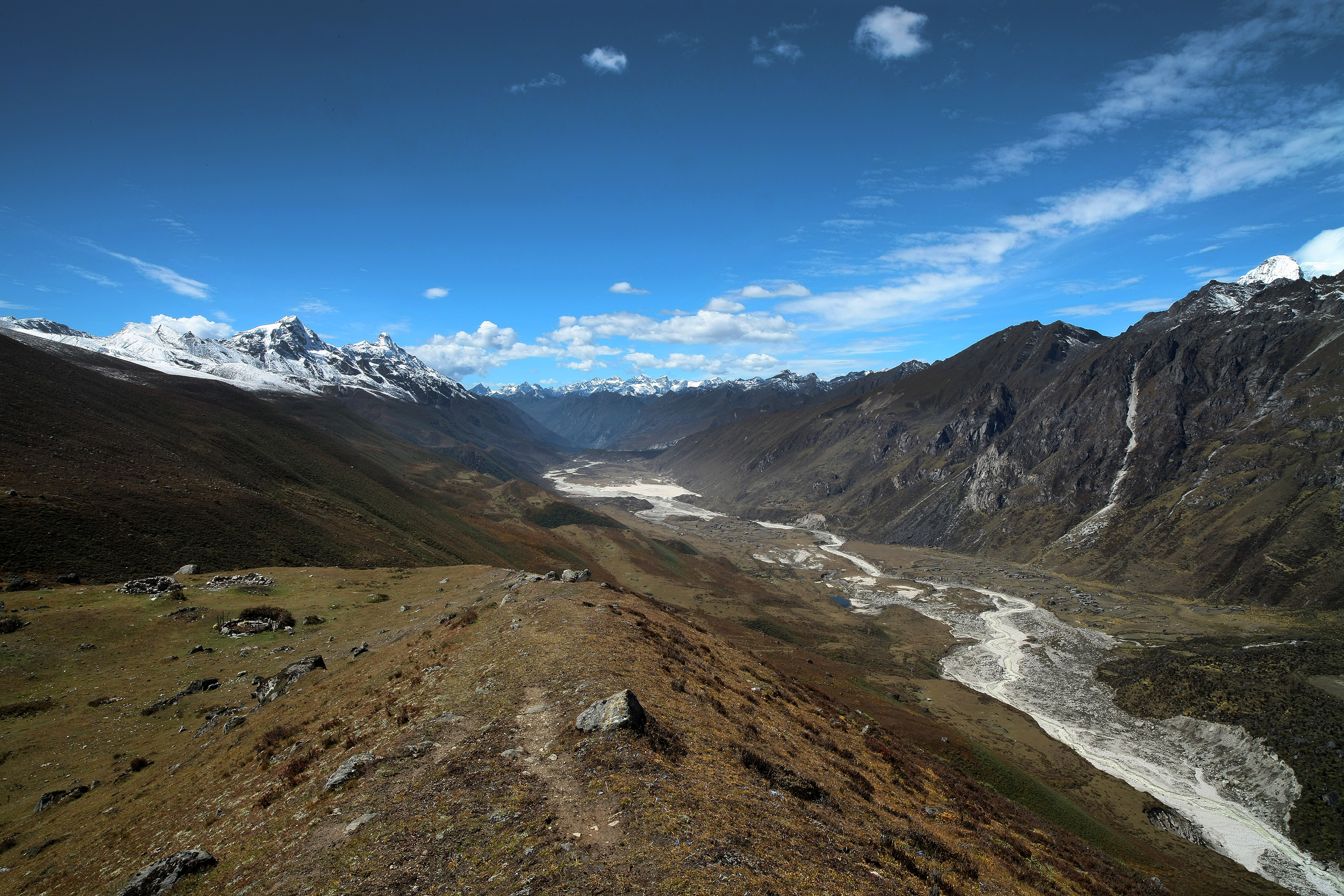
In clear weather, you will have great views of Table Mountain (7,100m). Around lunchtime you will pass the small village of Chozo (4,090m) which has a Dzong still in use. Reaching Thanza again you will have a great view of Table Mountain which forms a 3,000m high wall of snow and ice behind the village. Although there are possibilities to camp directly at Thanza, most groups prefer to camp in Thoencha.
Distance 17km, seven to eight hours, 450m ascent, camp altitude 4,150m.
Overnight: Camp at Thanza
Day 20: Rest Day at Thanza
In Thanza walk around and experience some village life or climb up the ridge for fascinating views of lakes and mountains. But as it takes time to arrange new yaks (the yaks from Laya will not go further than Thanza) you might have to spend one day at Thanza anyway.
Overnight: Camp at Thanza
Day 21: Thanza – Danji
From Thoencha, the trail climbs up to a large boulder from where you will have excellent views of Thanza, Toencha and Choso village and the surrounding mountains. After a few hours of relatively flat and easy walking, you will reach a yak meadow with some yak herders’ huts. It is an excellent campsite with a great chance to spot some blue sheep on the hills above. A trail junction near the campsite will give you the choice between the routes up to Gangkar Puensum base camp, and further on to Bumthang or to Sephu (Trongsa)
Distance 8km, three to four hours, 80m ascent, camp altitude 4,230m.
Overnight: Camp at Danji
Day 22: Danji – Tshochena
Having chosen the route to Sephu, the trek crosses the creek and after a long climb, you will reach Jaze La (5,150m) with spectacular panoramic mountain views. The path then descends between snow covered peaks and a couple of small lakes to the campsite near the Shore of Tshochena Lake.
Distance 12km, five to six hours, 980m ascent, 240m descent, camp altitude 4,970m.
Overnight: Camp at Tshochena
Day 23: Tshochena – Jichu Dramo
You follow the bank of the blue green lake before arriving at a ridge at 5,100m, where there is another spectacular view in all directions. After going up and down over small hills to reach a glacial lake, the route descends first before climbing again up the next pass, the Loju La (5,140m). Finally, after crossing a small saddle (5,100m) you will enter a wide glacial valley from where the trail descends gradually to the campsite at Jichu Dramo.
Distance 14km, four to five hours, 230m ascent, 150m descent, camp altitude 5,050m.
Overnight: Camp at Jichu Dramo
Day 24: Jichu Dramo – Chukarpo
Right after leaving the camp you will climb through a moraine to Rinchen Zoe La (5,320m). Spectacular mountain scenery with Gangkar Puensum amongst the impressive mountains is the reward for climbing the highest pass on this trek route. Rinchen Zoe Peak (5,650) towers above the pass to the west. Descending from the pass, the route leads into a wide valley with several lakes and goes steeply down along a moraine to the Thamphe Chhu. Here the vegetation begins to thicken again and you will see the first real trees since Lhedi. After a couple of hours you reach the campsite at Chukarpo.
Distance 18km, five to six hours, 320m ascent, 730m descent, camp altitude 4,600m.
Overnight: Camp at Chukarpo
Day 25: Chukarpo – Thampe Tsho
The descent continues along the river till you reach the yak herder huts at Gala Pang Chhu (4010m). From here the trail climbs steeply towards Thampe Tsho, a beautiful clear turquoise lake, with the campsite next to it.
Distance 18km, five to six hours, 400m ascent, 700m descent, camp altitude 4,300m.
Overnight: Camp at Thampe Tsho
Day 26: Thampe Tsho – Maurothang
From the lake you climb steeply to the last pass on your trek, the Thampe La (4,600m) with a good chance to spot some blue sheep on the way. Then the path descends to the sacred lake Om Thso. Passing a waterfall you will reach another, smaller lake 100m below to descend steeply to the Nikka Chhu. The path finally leads through mixed forest to large clearing on the banks of the river with a few yak herder huts, Maurothang.
Distance 14km, five hours, 330m ascent, 1020m descent, camp altitude 3,610m.
Overnight: Camp at Maurothang
Day 27: Maurothang – Sephu (Trek Ends)
On the last day of this extraordinary trek your porters will have to change from yaks to horses as the yaks will not be willing to go further down. The path follows the Nikka Chhu to reach a large grassy area overlooking the road and the village of Sephu. You finally reach the road at the Nikka Chhu Bridge at Sephu where you will find several stores (mainly selling bamboo products) and small restaurants.
Your vehicle will pick you up and drive to your lodge at Gangtey
Distance 18km, five to six hours, 990m descent.
Overnight: Hotel in Gangtey
Day 28: Gangtey to Punakha
Visit the Gangtey Monastery in the morning and head towards Punakha, the ancient capital of Bhutan.
Upon reaching Punakha; walk along the path through the traditional houses of Sopsokha village amidst agricultural fields of rice and mustard and visit Chimi Lhakhang, the temple of the Divine Mad Monk is located.
Sopsokha village is a typical example of clustered settlement. You may witness unusual paintings of phallus on the walls of the houses. The phallus paintings are traditionally believed to ward off evil influences and bad-mouth/gossips of others that bring bad luck.
A short drive along the river through the valley floor will lead you to the incredible Punakha Dzong. Punakha Dzong is just as striking inside as outside and it is arguably the most beautiful Dzong in Bhutan. Located magnificently between Pho Chhu (Male River) and Mo Chhu (Female River) confluence, the intricate carving and amazing architecture of the Dzong is a great source of inspiration. This famous structure built in the 1637 has a lot to tell about the historical background and various Tibetan invasions won from this strategically located Dzong. It also houses the kingdom’s most sacred relic, the “Rangjung Karsa-pani”.
Distance: 80kms/ Drive time: 3 Hours
Overnight: Hotel in Punakha
Day 29 : Punakha To Paro
Visit Punakha Dzong is just as striking inside as outside and it is arguably the most beautiful Dzong in Bhutan. Located magnificently between Pho Chhu (Male River) and Mo Chhu (Female River) confluence, the intricate carving and amazing architecture of the Dzong is a great source of inspiration. This famous structure built in the 1637 has lot to tell about the historical background and various Tibetan invasion won from this strategically located Dzong. It also houses the kingdom’s most sacred relic the “Rangjung Karsa-pani”.
Take a scenic drive from Punakha to Paro. Paro is a beautiful valley located in Western Bhutan with an area of 2800 Square kilometers. Breathtaking Lhakhangs and monasteries are perched on mountain hills. Two sacred rivers with its respective source at Jumolhari and Chumo Phug mountains, makes their way through Paro valley enhancing its beauty and grandeur
- Take a stroll through Paro town, a street of typical Bhutanese traditional buildings.
Overnight at hotel in Paro
Day 30 : Departure
Our team will drop you to the airport and bid you farewell.
Read Customer Reviews
5.0 / 2 Reviews
This was my second attempt to complete the Snowman Trek.
The first time I had booked my tour with the agent based in our country who was also organizing Bhutan Tour. But unfortunately due to the weather condition I could not complete and it was very expensive as well.
So this time I chose to directly book with the local agents in Bhutan. The tour cost was cheaper comparatively.
The trek is tough. I nearly gave up on half way . But my guide Mr. Sangay was very encouraging and did not allow me to give up. He had done the Snowma Trek several times and he was very comfortable with the route.
It was one of the most difficult trek that I have done so far but I pride myself in completing it.
I would specially like to thank Mr.Sangay without whose help this trek would not be possible.
I ventured into Snowman trek owing to the adjectives associated with it. Suppose to be the toughest trek in the world. But to my suprise, it also opened the window to Bhutan's spiritual heartland- A world within a world.
The trekking is not easy but the scenic beauty that this trek offers is out of the world. Prepare yourself for long hours of of never ending trek, the freezing cold and unexpected blizzard. Consult your doctor before venturing into this trek, it requires high level of fitness.
Thank you Mr. Sangay my guide and the lively trekking Crews. Without your support this trek would not have been possible.
It was once in a life time experience. Worth all the cost and endeavour.
Highlights